Today I was speaking with my father and he dropped in the conversation if I have tried the “Historical pictures” mode in Google Earth. (Historisches Bildmaterial auf Deutsch)
This historical images have been collected and curated by the GeoInformation group where taken by both the Royal Air Force (RAF) and United States Air Force (USAF) during WWII so they could plan where to drop their bombs and do city recconaissance. It’s interesting that now can be used for a much better reason and it’s really cool that Google added them to their Earth product.
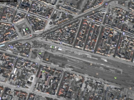
This is not a new feature, as it was rolled out in the beginning of 2009, but it seems is only available for some cities. As is for Berlin. Images are quite blurry in 1943 aerial shots, but they are quite good in 1953 and onwards. It’s interesting to see that a berlin post-war 1943 picture and how it was already partly reconstructed 10 years afterwards. At least for Berlin there is a gat of 57 years from 1953 till year 2000 where next aerial pictures appear on the map.
So if you are interested in history like me it would be very interesting to combine the Virtual Museum of Dead Places with this feature of Google Earth and make a mashup of how this abandoned structures changed over time.
Full list of cities where imagery is available:
- Aachen
- Augsburg
- Bamberg
- Berlin
- Bologna
- Bonn
- Bordeaux
- Breslau/ Wroclaw
- Brest
- Cologne
- Danzig/Gdańsk
- Dessau
- Dortmund
- Dresden
- Dusseldorf
- Florence
- Frankfurt
- Freiburg
- Genoa,
- Gottingen
- Hamburg
- Hannover
- Kiel
- Koblenz
- Leipzig
- Lyon
- Magdeburg
- Mainz
- Naples
- Nurnberg
- Regensburg
- Rome
- Split
- Strasburg
- Stuttgart
- Trieste
- Turin
- Venice
- Weisbaden
- Warsaw
Source; List taken from Historical WII Imagery nice blog check it out
Cancellation of my latest trip
Last weekend the urban exploration trip to Rüdersdorf was cancelled. It’s nice to bike in the snow but it’s crazy and quite dangerous to do it if the temperatures drop and you have the ice melting under your wheels.
